
12 August 2016
Last updated at 09:08
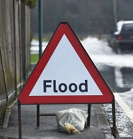
In their latest blog Groundsure explore the importance of Catchment Flood Management plans in England and Wales.
![]()
Catchment Flood Management Plans (CFMPs) have been produced by the Environment Agency (EA) to establish and plan future flood risk management activities, which will deliver long term sustainable risk management. There are 77 CFMPs in total for England and Wales, one for each individual river catchment (1).
Sustainable flood risk management has now become a central pillar in investment decision making for the future flood management schemes, ensuring appropriate design and longevity to prepare effectively for the impact of climate change (2).
 Background to CFMPs
During the latter part of the 20th century scientific research into the changing nature of rivers coincided with the acknowledgement that our global climate is changing (3). Understanding how rivers will react to a change in climate and predicting their future behaviour is crucial for future river management and flood defence projects, triggering a change in flood management ideology (4).
The acknowledgement that the flood risk posed by river is dynamic will have profound implications for current hard-engineered flood defences and flood management schemes which are designed to provide a certain level of protection (2). For example, designing a defence that provides protection against a 1 in 100 year flood event now may not be adequate in the future, as the recurrence interval (probability) and magnitude of a 1 in 100 year flood event may not be the same 20, 50 or 100 years in the future.
The Environment Agency handles the future management of flood risk within catchments. The sustainability decisions on land use and investments are outline in the EA’s CFMPs for each river catchment. Catchment Flood Management Plans have become a way for policy makers to intertwine new scientific understanding into river management policy, ensuring the consideration of future climate change (2).
Catchment Flood Management Plans have been designed to identify areas which are likely to see an increase in the number of properties at risk from flooding within the river catchment. They propose specific mitigation measures to improve future flood protection. Dividing the catchment up into different zones will ensure specific and tailored flood management policies are implemented appropriately.
The first section of a CFMP is an overview of the river catchment. The topography and geology of the catchment need to be considered as both have a significant influence on a river’s behaviour and the flooding characteristics it presents. Other important data is included, such as major urban areas or important infrastructure which needs to be protected.
The current and future flood risk potential for the catchment is then identified. This is achieved through the evaluation of historical flood records, modelled datasets, existing knowledge and projected future climatic scenarios.
The catchment is then split into different sub sections to account for the spatial nature of flood risk and identify/implement specific and tailored flood management policies for each of these sub- areas.
I live within higher reaches of the River Adur catchment and the EA CFMP for the River Adur is available to view online here (all other 77 CFMPs can be found on the EA CFMP section on the .Gov website – see reference section).
Analysis of the data produced by the EA on the number of properties at risk now and by 2100 (fig.1) shows that Worthing, Steyning and Upper Beeding and Brighton and Hove will see little increase in flood risk. However, Shoreham and Adur Estuary areas will experience a dramatic increase from a few properties to just under 1,800 properties at risk by 2100. The justification for this increase is predominantly a result of predicted increased magnitude of fluvial events coupled with significant tidal surges driven by climate change (EA, 2009) (5).

Figure (1). Graph showing current and future (2100) flood risk to property from a 1% annual probability of river flooding, taking into account current flood defences within the River Adur catchment (5).
As result of this potential increase in the number of homes at risk in the Shoreham and Adur Estuary areas, a number of future flood protection measures are proposed. Future projects include a study to investigate the future flood risk to Shoreham-By-Sea as a result of predicted sea level rise and the potential construction of the Adur Tidal Wall scheme (5).
The EA will strengthen development control advice by increasing the use of Sustainable Urban Drainage Systems (SUDS) and promote no increase in run-off from new developments through the Local Develop Framework Policy. Whilst also seeking opportunities to reduce current run-off rates across the Adur catchment (5).
Summary
CFMPs are an important tool in identifying and managing flood risk for the future. By understanding the effects of future climate on rivers, and in turn the nature of flood risk within a river catchment, better land use decision making and investment in flood protection schemes can be made. This will ultimately benefit ourselves whilst ensuring the health of our river systems and the ecosystems they support.
References
No events were found.